
Beaches
No matter how you spend your time on Jersey, you’ll no doubt want to feel either the sand between your toes or breathe in the fresh sea air as you explore our beaches and coves. They each have their own unique personality. Choose the one that’s right for you…
East coast
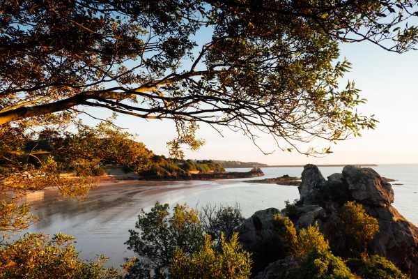
Anne Port Bay
Faces north-east
A quiet and rarely crowded east-facing stretch of sand that catches the morning and midday sun.
Geopark: Jersey’s own Giant’s Causeway: at low tide, the rocks of La Crête Point, left of the slipway, show six-sided columns of rhyolite that cooled from volcanic eruptions 580 million years ago.
National Park: On the coast walk from St. Catherine’s Breakwater to Gorey Pier, past the secluded bays of Archirondel and Anne Port.
Bus 2, 2a · Dog friendly · Parking
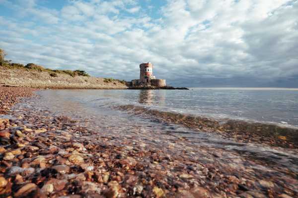
Archirondel Bay
Faces north-east
This popular beach with an excellent beach café is pebbly at first but sandy at low tide, when the water stays shallow for some way out. East-facing, Archirondel loses the sun in the late afternoon.
National Park: Guided kayak trips set off from here towards Mont Orgueil Castle or St. Catherine’s Breakwater, and the coast walk from the Breakwater to Gorey Pier passes by.
Bus 2, 2a · Wheelchair access
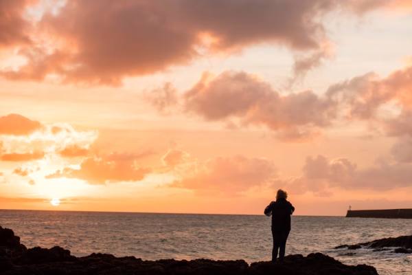
Fliquet Bay
Faces north-east
On the far north-east corner of the island, a quiet mix of pebbles, sand and rock with views across to France, sheltered from westerly winds. Bathing is safe at all states of the tide, though there are no lifeguards. It’s a ten-minute walk along the trail from the St. Catherine bus stop.
Geopark: A rare peat bed from the last Ice Age and fine exposures of Rozel Conglomerate, the pebbly rock of the north-east.
National Park: On the cliff-path walk from Rozel to St. Catherine’s Breakwater.
Bus 2, 2a · Parking
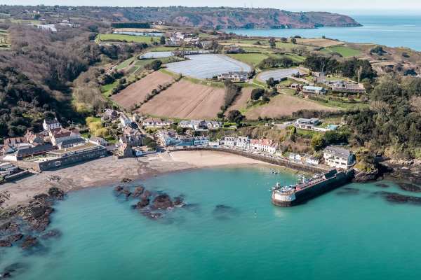
Rozel Bay
Faces north-east
A small fishing village lined with beach huts and harbourside cottages, Rozel is more of a fishing harbour than a place to swim. But at low tide, Rozel’s small stretch of white sand is safe for children to play; just look out for the Rozel geese!
Geopark: Above the harbour, Le Câtel de Rozel is an earthwork from the Iron Age.
National Park: A stop on the walk down from St. Martin’s Church, and the start of the cliff path on to Fliquet and St. Catherine’s.
Bus 3 · Dog friendly · Café or kiosk · Wheelchair access · Parking
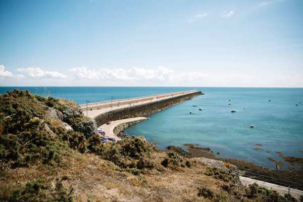
St. Catherine’s Bay
Faces east
Home to the island’s sailing and canoe clubs, the bay sits beside the Victorian breakwater, begun in 1847 as a naval harbour and never finished. Walk to the end and back, stop at the Breakwater Café, or take a sea swim and warm up at the Sauna Society.
Geopark: The breakwater, 700 metres long, is built of local stone, quarried at Verclut Point at its root.
National Park: The end of the cliff walk from Rozel and the start of the coast walk to Gorey Pier, with views across to France.
Bus 2, 2a · Dog friendly · Café or kiosk · Wheelchair access · Parking
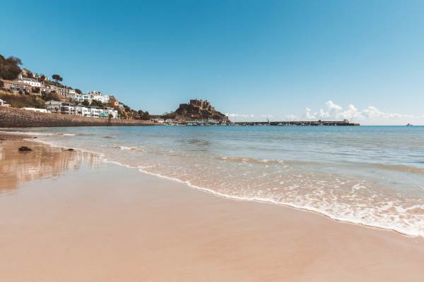
The Royal Bay of Grouville
Faces south-east
A long stretch of sand that leads to Gorey harbour, with Mont Orgueil Castle as a backdrop. Plenty of parking, beach cafés and kiosks as well as a children’s beachside playground and soft sand make Long Beach a local favourite.
Geopark: At the Gorey end, Petit Portelet and the rocks below Mont Orgueil show volcanic dykes and Ice Age features, where Palaeolithic tools have been found.
Bus 1, 1a, 2, 13 · Dog friendly · Café or kiosk · Wheelchair access · Parking
North coast
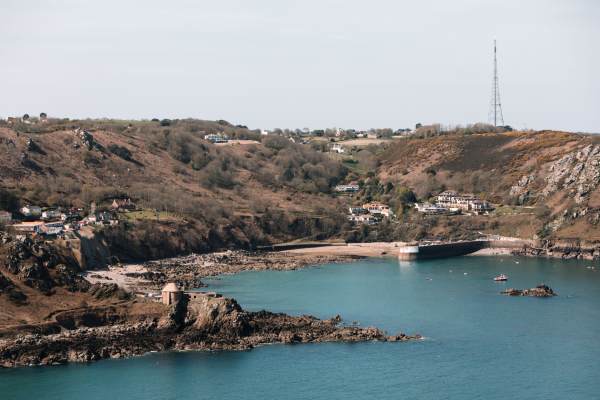
Bonne Nuit Bay
Faces north
A tiny fishing harbour with space to play on the sand, picnic or catch some sun, but more of a wild swim than some other beaches. Worth visiting for the excellent beach café.
Geopark: From the cliff path past La Crête Fort, Giffard Bay next door shows the best of the Jersey Volcanic Group: rocks around 580 million years old.
National Park: The circular walk from Bouley Bay takes in the coast to Bonne Nuit and Egypt Woods.
Bus 4 · Café or kiosk · Parking
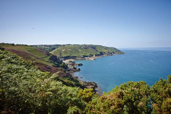
Bouley Bay
Faces north
A winding hill leads down to this steep pebble beach with deep water for competent swimmers. The bay is home to one of Jersey’s scuba-diving schools.
Geopark: L’Islet, the tidal island in the corner of the bay, keeps signs of Ice Age freezing and thawing, and the ridge above the pier, Les Hurets, has rare spherulites: crystals in clusters like bunches of grapes.
National Park: Reached on foot from Jardin d’Olivet past L’Etacquerel Fort, or on a circular walk along the coast to Bonne Nuit.
Bus 4 · Café or kiosk · Parking
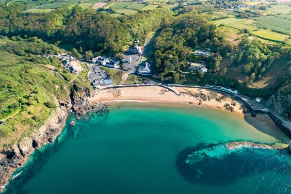
Grève de Lecq Beach
Faces north-west
The most popular of the north coast beaches, Grève de Lecq’s sheltered sands and rockpools are ideal for families but lose the sun in the late afternoon. Don’t miss the excellent cafés and local pubs close by. Even in the winter months, some providers offer coasteering trips for guided cold-water dips!
Geopark: The beach shows St. Mary’s granite, lamprophyre dykes and the shapes the sea has made of the coast; Le Câtel de Lecq stands above.
National Park: The start of the cliff path to Plémont, with views to Guernsey, Sark and France; the barracks above are the last on the north coast.
Bus 9 · Dog friendly · Café or kiosk · Parking
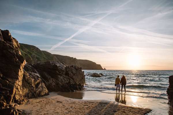
Plémont Bay
Faces north-west
A pristine sandy cove reachable by a long flight of steps, where the intrepid are rewarded with a stunning natural playground of rock pools and sea caves. There’s safe swimming when the sea is calm, and surfing when it’s wild. The beach is completely covered at high tide. It’s quite a walk down from the bus stop, so pack sensible footwear!
Geopark: Grève au Lanchon to the Geopark: the sea has worked the weak lines in the granite into caves, stacks and arches.
National Park: Caves with their own waterfalls, rock pools and surf; the headland has some of Jersey’s last nesting puffins, in a marine protection zone.
Bus 8 · Café or kiosk · Parking
West coast
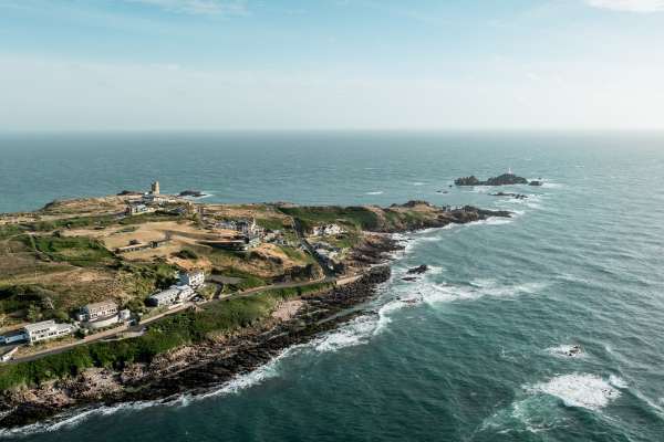
Petit Port Beach
Faces west
A small, quiet beach of golden sand below the cliffs near La Corbière, away from the busier bays. There’s little close by, so bring a picnic; coastal paths lead off to lookouts and hidden coves.
National Park: “Peaceful Petit Port” is on the walk along the whole Atlantic coast, from Grosnez Point to Corbière Lighthouse.
Bus 12a, 22 · Parking
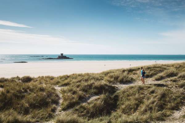
St. Ouen’s Bay
Faces west
A magnificent beach and natural playground for surfers and adrenaline seekers. It’s where one of the oldest surfing clubs in Europe has its home and makes a stunning setting for beach walks. Swimmers should take care in the strong currents and stick to the flagged zones. The beach is patrolled by RNLI lifeguards during the season.
Geopark: At low tide, when the sand allows, the stumps of a 5,000-year-old forest show in the peat beds; behind the bay, the dunes of Les Blanches Banques hold standing stones.
National Park: After a winter storm, comb the bay for driftwood, egg cases, cuttlefish and goose barnacles, or climb the dunes for a view of the whole bay.
Bus 22, X22 · Dog friendly · Café or kiosk · Wheelchair access · Parking
South coast
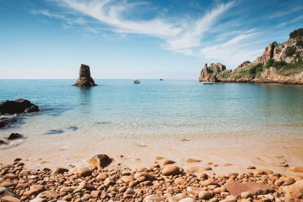
Beauport Bay
Faces south-west
A real suntrap on the south coast. Once you’ve wandered down the steep path from the car park and crossed the pebbles, you’ll reach a sheltered south-facing beach with golden sand and shallow turquoise water, ideal for swimming.
Geopark: Pale Beauport granite, worn into caves, stacks and blowholes, with Ice Age deposits.
National Park: The headland’s little wood of evergreen oaks has a taste of the Mediterranean; it was given to the island by Lord Trent, of the Boots family.
Bus 12a, 14, 22 · Parking
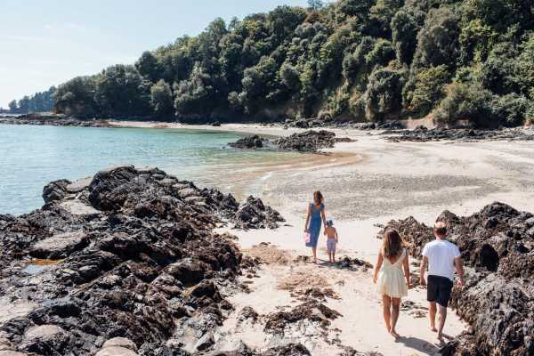
Belcroute Bay
Faces east
A small, secluded shingle cove on the Noirmont side of St. Aubin’s Bay. Go early: it loses the sun soon after midday. At high tide the sheltered water is good for swimming, snorkelling and paddleboarding; keep away from the rocks to the south, where the currents run strong. There are no lifeguards.
Geopark: Layers in the cliffs behind the inlets record the Ice Ages: pollen and insects in the mud date from perhaps 186,000 years ago, when the climate was much colder.
National Park: Noirmont headland above is a protected Site of Special Interest, with German bunkers from the Occupation and the island’s war memorial.
Bus 12a · Parking
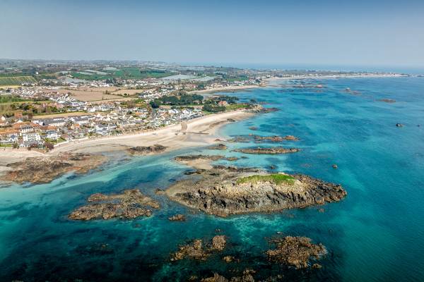
Green Island
Faces south-east
A locals’ favourite, this sheltered south-facing beach is a real sun trap where soft sand, rock climbing and rock pool adventures await. The tide goes out a long way, so take care with the swift incoming tide and pick times close to high water to enjoy swimming or paddling.
Geopark: In one of Europe’s largest intertidal Ramsar sites. Eighteen stone graves were found on the island in 1911–14; it was still joined to Jersey in the 17th century. Le Nez, at one end of the beach, is the best place in Jersey to see layering in igneous rock.
Bus 1 · Dog friendly · Café or kiosk · Wheelchair access · Parking
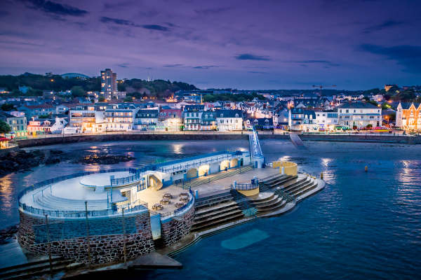
Havre des Pas
Faces south
Close to the centre of St. Helier, this sandy beach is worth a visit to see the architecture of the art deco pool, filled by the tide each day. The beach is easy to access, and safe for swimmers.
Geopark: The best place to see Dicq granite and the Jersey Dyke Swarm. On South Hill above, Jersey’s highest raised beach sits 30 metres above the sea.
Bus 1, 1a · Café or kiosk · Wheelchair access
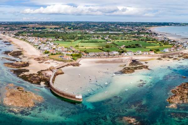
La Rocque Harbour
Faces south-east
A small fishing harbour on the south-east tip, with a sandy beach and a long breakwater for a stroll. Low tide uncovers miles of sand, gullies and reefs for rock-pooling, but the tide comes back fast, so check the times. Swim at high tide, with care on the rocks. The Hard Rocque Café kiosk on the breakwater serves breakfasts, lunches and ice creams.
Geopark: The best place to study La Rocque granite, with Ice Age deposits and landforms.
Bus 1 · Café or kiosk · Parking
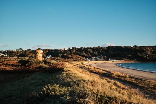
Ouaisné Bay
Faces south-west
This south-west facing beach is the wilder contrast to the adjoining St. Brelade’s Bay. The beaches are connected at low tide, or cross the pine-rich headland and walk along the sea wall next to the protected Ouaisné Common towards locals’ favourite, The Smugglers Inn.
Geopark: In the headland between Ouaisné and St. Brelade’s Bay, La Cotte de St Brelade sheltered Neanderthals: one of Europe’s most important Ice Age sites. Visit only with a guide.
National Park: Ouaisné Common, behind the beach, is home to the rare Jersey grass snake and the green lizard.
Bus 12a · Café or kiosk · Parking
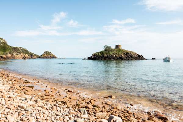
Portelet Bay
Faces south-west
Climb down the long flight of steps and you’ll be rewarded with a sunny, sheltered and sandy beach circling Janvrin’s Tomb at the centre. Portelet Bay Café serves excellent pizza throughout the season, and the pub at the top of the steps, the Old Portelet Inn, is a family favourite.
Geopark: Between the steps from the pub and the beach café, rounded cobbles up to eight metres above the sea are a raised beach from the last warm period before the Ice Age.
National Park: Portelet’s headland, a Site of Special Interest since 2007, is a stronghold of the south-west’s heathland and its birds.
Bus 12a · Café or kiosk · Parking
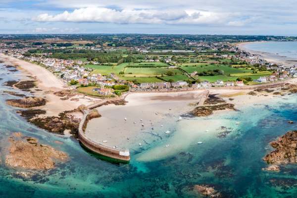
Robin Bay
Faces south-east
A small, sandy cove next to La Rocque Harbour, up the steps at the corner of the pier. A sun trap with soft sand, rock pools and rocks to clamber on, and easy to keep an eye on little ones. The currents can be strong: swim inside the sheltered cove.
Geopark: Part of the La Rocque geosite: the best place to study La Rocque granite, with Ice Age deposits and landforms.
Bus 1 · Dog friendly · Café or kiosk · Parking
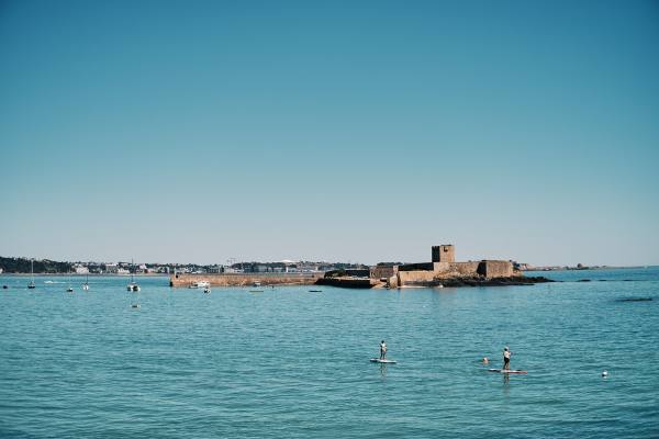
St. Aubin’s Bay
Faces south
A crescent of south-facing sand from St. Helier to St. Aubin, the beach is in full sun for most of the day. With several beach cafés along the promenade, look out for the softest sand around the Gunsite Café, with jet ski hire close by.
National Park: From St. Aubin, the walk to Noirmont Point climbs Mont Arthur for some of the best coastal views on the island.
Bus 12a, 14, 15 · Dog friendly · Café or kiosk · Wheelchair access · Parking
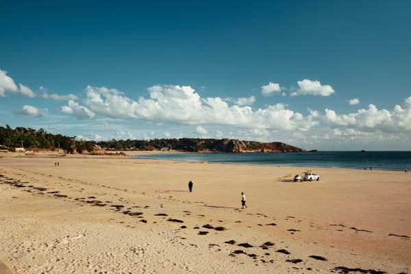
St. Brelade’s Bay
Faces south
The beautiful beach at St. Brelade’s Bay is one of the island’s busiest; a visitor favourite for its soft sand, safe swimming, beach activities and seaside eating. Voted number three in the Tripadvisor Travellers’ Choice awards, this stunning south-facing beach is in the sun for most of the day.
Geopark: St. Brelade’s Church and the Fishermen’s Chapel, at the western end, are early Norman, noted too for their lichens; La Cotte, the Neanderthal site, is in the headland towards Ouaisné.
Bus 12a, 14 · Dog friendly · Café or kiosk · Wheelchair access · Parking
Notes on the rocks and history from the aspiring Jersey Island Geopark ↗, and on wildlife and walks from Jersey National Park ↗.
Tides
Jersey’s tidal range is one of the largest in the world, at around 12 metres, and the sea comes back quickly: it’s easy to get caught out. Stray too far from the shore and the tide can cut you off. Check the tide times, pay close attention to the signs and know the dangers.
Safe swimming
The RNLI’s lifeguards watch over the popular bays in the season: swim between the red and yellow flags. rnlijersey.org.je
BeachAbility
Beach wheelchairs that glide over sand and stone, lent free to anyone with a permanent or temporary mobility difficulty, at West Park, Bel Royal Kiosk and the Gunsite Café on St. Aubin’s Bay, Le Braye Café in St. Ouen’s Bay, St. Brelade’s Bay, Long Beach in Gorey and La Mare Slip in St. Clement. +44 (0) 7797 935088, beachability.org